LG Sports

LG Sports
an LG Enterprises, LLC Company

  
  home | products | Order Status | UPS Tracking | search | checkout | contact  
 
  PRODUCTS    
Home
About Us
All Products
Camping
Cases and Bags
Clothing
Flash Lights
Gun Care
Holsters
Knives
Optics
Service
Shipping
Links of Interest

Shopping cart  Shopping cart
0 Product(s) in cart
Total $0.00
» Checkout

LG Sports
The first step in your next sporting adventure

Email:
Service@lg-sports.com
Phone:
1-888-547-4679

We Accept
Acceptance Mark


Home » Marine and Boating
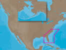
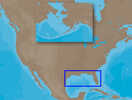
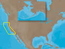
 Checkout

C-MAP MAX SA-M500 - Costa Rica-Chile Falklands - SD Card
Product ID: CW_17593

Details 

SA-M500 => Costa Rica to Chile to FalklandsCoverage starts at Bahia de Salinas on Costa Rica's Pacific coast, and extends south and east along the coasts of Panama, Colombia, Ecuador, Peru and Chile, wrapping around Cape Horn and back up along the Atlantic coast of Argentina, stopping at Quequen. Coverage includes the offshore islands of the Galapagos, Falklands and South Georgia.
Out of Stock

C-MAP MAX SA-M501 - Gulf of Paria - Cape Horn - SD Card
Product ID: CW_17594

Details 

SA-M501 => Gulf of Paria to Cape HornCoverage starts at Quintero, Chile on the Pacific coast and extends south down the Chile border, wraps up around Cape Horn and continues up the Atlantic coasts of Argentina, Uruguay, Brazil, French Guiana, Suriname, Guyana and into Venezuela, ending at Punta Carenero. Coverage includes Trinidad, Tobago and the Caribbean Islands of Grenada, Carriacou, the Grenadines, St. Vincent and Barbados. Also includes coverage of the Amazon River to Manaus, Brazil
Out of Stock

C-MAP MAX SA-M500 - Costa Rica-Chile-Falklands - C-Card
Product ID: CW_18919

Details 

SA-M500 => Costa Rica to Chile to FalklandsCoverage starts at Bahia de Salinas on Costa Rica's Pacific coast, and extends south and east along the coasts of Panama, Colombia, Ecuador, Peru and Chile, wrapping around Cape Horn and back up along the Atlantic coast of Argentina, stopping at Quequen. Coverage includes the offshore islands of the Galapagos, Falklands and South Georgia.
Out of Stock

C-MAP NT+ SA-C004 - Puerto Bolivar-Rio De Janeiro - Furuno FP-Card
Product ID: CW_25082

Details 

NT+ SA-C004 - Puerto Bolivar-Rio De Janeiro - Furuno FP-CardCoverage Area:Puerto Bolivar to Rio de JaneiroFor:Furuno FP-Card
Out of Stock

C-MAP MAX NA-M321 - Cape Henry, NC-Apalachicola, FL - SD™ Card
Product ID: CW_28209

Details 

NA-M321 => Cape Henry to Apalachicola BayCoverage includes offshore bathymetric details from Cape Henry, VA to Apalachicola Bay, FL. Coverage extends from the coastline out to the offshore Atlantic Canyons - Norfolk, Washington and others. Some coverage of the Bahamas is also included, covering western Northwest Providence Channel and the banks and shoals around Bimini. Fishing Contour Charts do not include coastal navigational features and are recommended for offshore fishing only
Out of Stock

C-MAP MAX NA-M420 - Gulf of Mexico: Bathy - SD™ Card
Product ID: CW_28210

Details 

NA-M420 => Gulf of MexicoCoverage includes the offshore bathymetric details for the Gulf of Mexico from Key West, FL over and around to Brownsville, TX. Additional coverage up the eastern coast of Florida to Jacksonville is included. Some coverage of the Bahamas is also included, covering western Northwest Providence Channel and the banks and shoals around Bimini. Fishing Contour Charts do not include coastal navigational features and are recommended for offshore fishing only
Out of Stock

C-MAP MAX NA-M620 - San Diego, CA-Cape Blanco, OR - SD™ Card
Product ID: CW_28211

Details 

NA-M620 => San Diego to Cape BlancoCoverage includes the offshore bathymetric details for the coast of California and southern coast of Oregon, up to Cape Blanco. Complete coverage of the Channel Islands is also included. Fishing Contour Charts do not include coastal navigational features and are recommended for offshore fishing only
Out of Stock

C-MAP MAX NA-M621 - Cape Blanco, OR-Puget Sound - SD™ Card
Product ID: CW_28212

Details 

NA-M621 => Cape Blanco to Puget SoundCoverage includes the offshore bathymetric details for the coasts of Oregon and Washington. Coverage actually starts around the Klamath River delta in California and goes up to Cape Flattery, and around into Puget Sound. Coverage of the San Juan Islands up to Point Roberts is also included. Fishing Contour Charts do not include coastal navigational features and are recommended for offshore fishing only.
Out of Stock

C-MAP MAX NA-M012 - Canada North & East - C-Card
Product ID: CW_30126

Details 

NA-M021 => Canada North and EastCoverage of the Arctic and Atlantic coasts of Canada including Hudson Bay, Newfoundland, the Gulf of St. Lawrence, Nova Scotia and the Bay of Fundy. Also includes coverage of the St. Lawrence River and eastern Lake Ontario, MacKenzie River, Great Bear Lake and all of Passamaquoddy Bay.
Out of Stock

C-MAP MAX NA-M026 - Great Lakes & The Maritimes - C-Card
Product ID: CW_30127

Details 

NA-M026 => Great Lakes, Northeast Coast and ApproachesCoverage of the Great Lakes, St. Lawrence River and Northeast United States. Coverage of the Great Lakes also includes Fox River and Lake Winnebago, Lake St. Clair, Rideau Canal, Ottawa River and the Trent-Severn Waterway. Includes all coastal charts for New Brunswick and Nova Scotia in Canada and Maine, New Hampshire, Massachusetts, Connecticut and New York in the U.S. Also included is coverage of the Hudson River and Lake Champlain as we
Out of Stock

C-MAP MAX NA-M023 - U.S. Gulf Coast & Inland Rivers - C-Card
Product ID: CW_30128

Details 

NA-M023 => Gulf of Mexico, Great Lakes and RiversCoverage of the Gulf states, starting from Boca Raton, FL, down to Key West, FL, then back up and around the Gulf to Brownsville, TX. Also includes coverage of all the Great Lakes: Erie, Superior, Ontario, Huron and Michigan. Coverage of the Great Lakes also includes Fox River and Lake Winnebago, Lake St. Clair and the Trent-Severn Waterway. River coverage includes the Mississippi River, Ohio River, Illinois River, Arkansas River, Red River, Ou
Out of Stock

C-MAP MAX NA-M022 - U.S. East Coast & The Bahamas - C-Card
Product ID: CW_30129

Details 

NA-M022 => USA East Coast and BahamasCoverage of the United States Atlantic coast from Passamaquoddy Bay, ME down to Key West, FL, with extended coverage into the Gulf of Mexico over to Perdido Bay, FL. Includes coverage of Bermuda and all of the Bahamas. Also includes coverage of the Hudson River, Lake Champlain, Erie Barge Canal, Savannah River, St John's River and Okeechobee Waterway. Caribbean coverage includes charts from Explorer Chartbooks and Wavey Line Publising
Out of Stock

C-MAP MAX NA-M027 - Central America & The Caribbean - C-Card
Product ID: CW_30131

Details 

NA-M027 => Central America and CaribbeanCoverage of Central America, all of the Caribbean and the northern coast of South America, and the Gulf of Mexico. Coverage of the Pacific coast starts at Point Conception, CA and runs down to Bahia Cupica, Colombia. Coverage of the United States starts in Cumberland Sound, GA and runs down around Florida and over to Brownsville, TX. Bahamas, Turks and Caicos and all islands of the Caribbean are included. South American coverage includes the northern c
Out of Stock

C-MAP MAX NA-M024 - U.S. West Coast & Hawaii - C-Card
Product ID: CW_30132

Details 

NA-M024 => USA West Coast and HawaiiCoverage of the Pacific Coast of the United States, including all of the coasts of California, Oregon and Washington. Coverage of Baja California and Mexico down to Puerto Vallarta. Detail of the Columbia River, Sacramento River, Willamette River. Snake River and San Joaquin Rivers are also included. Full coverage of Puget Sound and the San Juan Islands up to Point Roberts is also included. Additional coverage of the Hawaiian Islands out to Midway and Joh
Out of Stock

C-MAP MAX NA-M025 - Canada West - C-Card
Product ID: CW_30133

Details 

NA-M025 => Canada WestCoverage of British Columbia, Puget Sound and the San Juan Islands. Full coverage of Vancouver Island and the Queen Charlotte Islands is also included. Full coverage of Puget Sound and the Strait of Juan De Fuca are also present. Extended coverage of the Vancouver Harbor area includes Pitt Lake, Indian Arm and Harrison Lake.
Out of Stock

C-MAP MAX NA-M028 - Alaska - C-Card
Product ID: CW_30134

Details 

NA-M028 => AlaskaCoverage of the southern Alaska coast from Dixon Entrance up and over to Kodiak Island. Includes all of the Aleutian Islands out to Attu Island, Bristol Bay, and the North Slope over to Liverpool Bay in the Yukon Territory, Canada. Additional coverage of the MacKenzie River down to the 1160 km distance marker.
Out of Stock

C-MAP MAX NA-M021 - Canada North & East - SD™ Card
Product ID: CW_30142

Details 

NA-M021 => Canada North and EastCoverage of the Arctic and Atlantic coasts of Canada including Hudson Bay, Newfoundland, the Gulf of St. Lawrence, Nova Scotia and the Bay of Fundy. Also includes coverage of the St. Lawrence River and eastern Lake Ontario, MacKenzie River, Great Bear Lake and all of Passamaquoddy Bay.
Out of Stock

C-MAP MAX NA-M026 - Great Lakes & The Maritimes - SD™ Card
Product ID: CW_30143

Details 

NA-M026 => Great Lakes, Northeast Coast and ApproachesCoverage of the Great Lakes, St. Lawrence River and Northeast United States. Coverage of the Great Lakes also includes Fox River and Lake Winnebago, Lake St. Clair, Rideau Canal, Ottawa River and the Trent-Severn Waterway. Includes all coastal charts for New Brunswick and Nova Scotia in Canada and Maine, New Hampshire, Massachusetts, Connecticut and New York in the U.S. Also included is coverage of the Hudson River and Lake Champlain as we
Out of Stock

C-MAP MAX NA-M023 - U.S. Gulf Coast & Inland Rivers - SD™ Card
Product ID: CW_30144

Details 

NA-M023 => Gulf of Mexico, Great Lakes and RiversCoverage of the Gulf states, starting from Boca Raton, FL, down to Key West, FL, then back up and around the Gulf to Brownsville, TX. Also includes coverage of all the Great Lakes: Erie, Superior, Ontario, Huron and Michigan. Coverage of the Great Lakes also includes Fox River and Lake Winnebago, Lake St. Clair and the Trent-Severn Waterway. River coverage includes the Mississippi River, Ohio River, Illinois River, Arkansas River, Red River, Ou
Out of Stock

C-MAP MAX NA-M022 - U.S. East Coast & The Bahamas - SD™ Card
Product ID: CW_30145

Details 

NA-M022 => USA East Coast and BahamasCoverage of the United States Atlantic coast from Passamaquoddy Bay, ME down to Key West, FL, with extended coverage into the Gulf of Mexico over to Perdido Bay, FL. Includes coverage of Bermuda and all of the Bahamas. Also includes coverage of the Hudson River, Lake Champlain, Erie Barge Canal, Savannah River, St John's River and Okeechobee Waterway. Caribbean coverage includes charts from Explorer Chartbooks and Wavey Line Publising
Out of Stock

C-MAP MAX NA-M027 - Central America & The Caribbean - SD™ Card
Product ID: CW_30146

Details 

NA-M027 => Central America and CaribbeanCoverage of Central America, all of the Caribbean and the northern coast of South America, and the Gulf of Mexico. Coverage of the Pacific coast starts at Point Conception, CA and runs down to Bahia Cupica, Colombia. Coverage of the United States starts in Cumberland Sound, GA and runs down around Florida and over to Brownsville, TX. Bahamas, Turks and Caicos and all islands of the Caribbean are included. South American coverage includes the northern c
Out of Stock

C-MAP MAX NA-M024 - U.S. West Coast & Hawaii - SD™ Card
Product ID: CW_30147

Details 

NA-M024 => USA West Coast and HawaiiCoverage of the Pacific Coast of the United States, including all of the coasts of California, Oregon and Washington. Coverage of Baja California and Mexico down to Puerto Vallarta. Detail of the Columbia River, Sacramento River, Willamette River. Snake River and San Joaquin Rivers are also included. Full coverage of Puget Sound and the San Juan Islands up to Point Roberts is also included. Additional coverage of the Hawaiian Islands out to Midway and Joh
Out of Stock

C-MAP MAX NA-M025 - Canada West - SD™ Card
Product ID: CW_30148

Details 

NA-M025 => Canada WestCoverage of British Columbia, Puget Sound and the San Juan Islands. Full coverage of Vancouver Island and the Queen Charlotte Islands is also included. Full coverage of Puget Sound and the Strait of Juan De Fuca are also present. Extended coverage of the Vancouver Harbor area includes Pitt Lake, Indian Arm and Harrison Lake.
Out of Stock

C-MAP MAX NA-M028 - Alaska - SD™ Card
Product ID: CW_30149

Details 

NA-M028 => AlaskaCoverage of the southern Alaska coast from Dixon Entrance up and over to Kodiak Island. Includes all of the Aleutian Islands out to Attu Island, Bristol Bay, and the North Slope over to Liverpool Bay in the Yukon Territory, Canada. Additional coverage of the MacKenzie River down to the 1160 km distance marker.
Out of Stock

C-MAP MAX NA-M033 - ATL Coast Gulf & Caribbean - SD™ Card
Product ID: CW_30153

Details 

NA-M033 => Atlantic Coast, Gulf of Mexico and CaribbeanCoverage includes most of the eastern coastline of North America. Canadian coverage starts in Arctic Canada and continues east to Hudson Bay, Ungava Bay and Frobisher Bay before continuing south down the Labrador coast to Newfoundland, the Gulf of St. Lawrence and Nova Scotia. The St. Lawrence River is covered down to Montreal. US coverage picks up at Passamaquoddy Bay and heads south down the Atlantic coast, picking up all of Chesapeake
Out of Stock

C-MAP MAX NA-M035 - Pacific Coast & Central - SD™ Card
Product ID: CW_30154

Details 

NA-M035 => Pacific Coast and Central America Coverage includes all of the western coastline of North America. Coverage starts at the Mexico/US border in the Gulf of Mexico and picks up the Belize, Guatemala, Honduras, Nicaragua, Costa Rica and Panama coasts then through the Panama Canal and back up the Pacific coast of Latin America covering all of the Pacific coasts up to the US border, including the Sea of Cortez. US coverage then picks up in San Diego and encompasses all of the coastline fo
Out of Stock

C-MAP NT+ NA-C046 - Cumberland River - C-Card
Product ID: CW_43487

Details 

Cumberland River
Out of Stock

C-MAP 4D NA-D024 - USA West Coast & Hawaii - Full Content
Product ID: CW_48109

Details 

NA-D024 - U.S. West Coast to Mexico and HawaiiCoverage of the Pacific Coast of the United States, including all of the coasts of California, Oregon and Washington. Coverage of Baja California and Mexico down to Puerto Vallarta. Detail of the Columbia River, Sacramento River, Willamette River. Snake River and San Joaquin Rivers are also included. Full coverage of Puget Sound and the San Juan Islands up to Point Roberts is also included. Additional coverage of the Hawaiian Islands out to Midway an
Out of Stock

C-MAP 4D NA-D028 - Alaska - Full Content
Product ID: CW_48115

Details 

NA-D028 - AlaskaCoverage of the southern Alaska coast from Dixon Entrance up and over to Kodiak Island. Includes all of the Aleutian Islands out to Attu Island, Bristol Bay, and the North Slope over to Liverpool Bay in the Yukon Territory, Canada. Additional coverage of the MacKenzie River down to the 1160 km distance marker.Full 4D ContentWhen you choose Full 4D content you will experience the latest in navigation data and technology such as:3D Chart View - The world has three dimensions. When
Out of Stock

C-MAP NT+ NA-C392 ICW Norfolk to West Palm Florida- C-Card Format
Product ID: CW_75817

Details 

NT+ NA-C392 ICW Norfolk to West Palm Florida - C-Card FormatCoverage Area: ICW Norfolk to West Palm FloridaCard Format: C-CardC-MAP NT+ cartography helped launch a digital charting revolution years ago, and it is still as useful and reliable as ever. For fishermen, sailors and cruisers who continue to depend on C-MAP NT+, C-Map provides updates twice annually to ensure that navigators benefit from all the latest Coast Guard Notice to Mariner (NTM) changes and other important chart data updates.R
Out of Stock

C-MAP NT+ NA-C398 Okeechobee Waterway - C-Card Format
Product ID: CW_76119

Details 

NA-C398 Okeechobee Waterway - C-Card FormatCard Format: C-CardSoftware: C-Map NT+C-MAP NT+ cartography helped launch a digital charting revolution years ago, and it is still as useful and reliable as ever. For fishermen, sailors and cruisers who continue to depend on C-MAP NT+, C-Map provides updates twice annually to ensure that navigators benefit from all the latest Coast Guard Notice to Mariner (NTM) changes and other important chart data updates.Rich chart detail and available data to aid in
Out of Stock

C-MAP NT+ NA-C395 Trenton NJ to C&D Canal to Nanticoke River - C-Card Format
Product ID: CW_76120

Details 

NA-C395 Trenton NJ to C & D Canal to Nanticoke River - C-Card FormatCard Format: C-CardSoftware: C-Map NT+C-MAP NT+ cartography helped launch a digital charting revolution years ago, and it is still as useful and reliable as ever. For fishermen, sailors and cruisers who continue to depend on C-MAP NT+, C-Map provides updates twice annually to ensure that navigators benefit from all the latest Coast Guard Notice to Mariner (NTM) changes and other important chart data updates.Rich chart detail
Out of Stock

C-MAP 4D NA-D062 Nova Scotia to Chesapeake Bay - microSD™/SD™
Product ID: CW_76122
Free Ground Shipping on this item.

Details 

NA-D062 Nova Scotia to Chesapeake Bay - microSD™/SD™Card Format: SD/MicroSDSoftware: C-Map 4D
Out of Stock

C-MAP 4D NA-063 Chesapeake Bay to Cuba - microSD™/SD™
Product ID: CW_76123

Details 

NA-063 Chesapeake Bay to Cuba - microSD™/SD™Card Format: SD/MicroSDSoftware: C-Map 4D
Out of Stock

C-MAP 4D NA-D061 Great Lakes & St Lawrence Seaway -microSD™/SD™
Product ID: CW_76124

Details 

NA-D061 Great Lakes & St Lawrence Seaway - microSD™/SD™Card Format: SD/MicroSDSoftware: C-Map 4D
Out of Stock

C-MAP 4D NA-D064 Gulf of Mexico - microSD™/SD™
Product ID: CW_76125

Details 

NA-D064 Gulf of Mexico - microSD™/SD™ Card Format: SD/MicroSDSoftware: C-Map 4D
Out of Stock

C-MAP 4D NA-D065 Caribbean & Central America -microSD™/SD™
Product ID: CW_76126

Details 

NA-D065 Caribbean & Central America - microSD™/SD™Card Format: SD/MicroSDSoftware: C-Map 4D
Out of Stock

C-MAP NT+ NA-C396 Chesapeake Bay from Pocomoke River to Norfolk - C-Card Format
Product ID: CW_76127

Details 

NA-C396 Chesapeake Bay from Pocomoke River to Norfolk - C-Card FormatCard Format: C-CardSoftware: C-Map NT+C-MAP NT+ cartography helped launch a digital charting revolution years ago, and it is still as useful and reliable as ever. For fishermen, sailors and cruisers who continue to depend on C-MAP NT+, C-Map provides updates twice annually to ensure that navigators benefit from all the latest Coast Guard Notice to Mariner (NTM) changes and other important chart data updates.Rich chart detail an
Out of Stock

C-MAP NT+ NA-C714 Puget Sound & Straits of Juan De Fuca - C-Card Format
Product ID: CW_76128

Details 

NA-C714 Puget Sound & Straits of Juan De Fuca - C-Card FormatCard Format: C-CardSoftware: C-MAP NT+C-MAP NT+ cartography helped launch a digital charting revolution years ago, and it is still as useful and reliable as ever. For fishermen, sailors and cruisers who continue to depend on C-MAP NT+, C-Map provides updates twice annually to ensure that navigators benefit from all the latest Coast Guard Notice to Mariner (NTM) changes and other important chart data updates.Rich chart detail and av
Out of Stock

C-MAP NT+ NA-C715 San Juan Islands - C-Card Format
Product ID: CW_76129

Details 

NA-C715 San Juan Islands - C-Card FormatCard Format: C-CardSoftware: C-Map NT+C-MAP NT+ cartography helped launch a digital charting revolution years ago, and it is still as useful and reliable as ever. For fishermen, sailors and cruisers who continue to depend on C-MAP NT+, C-Map provides updates twice annually to ensure that navigators benefit from all the latest Coast Guard Notice to Mariner (NTM) changes and other important chart data updates.Rich chart detail and available data to aid in sa
Out of Stock

« Previous | ...150 | 151 | 152 | 153 | 154 | 155 | 156 | 157 | 158 | 159 | 160... | Next »


This store has only Paypal and Google acceptable goods. So the number of products listed here is limited.

    Home ] About Us ] All Products ] Camping ] Cases and Bags ] Clothing ] Flash Lights ] Gun Care ] Holsters ] Knives ] Optics ] Service ] Shipping ] Links of Interest ]